America’s best drives aren’t always the famous ones. From wildflower-strewn mountain byways to empty coastal highways, these 13 hidden routes serve up big scenery and small crowds.
If you love winding roads and fresh discoveries, grab your keys—these under-the-radar byways deserve a spot on every enthusiast’s bucket list.
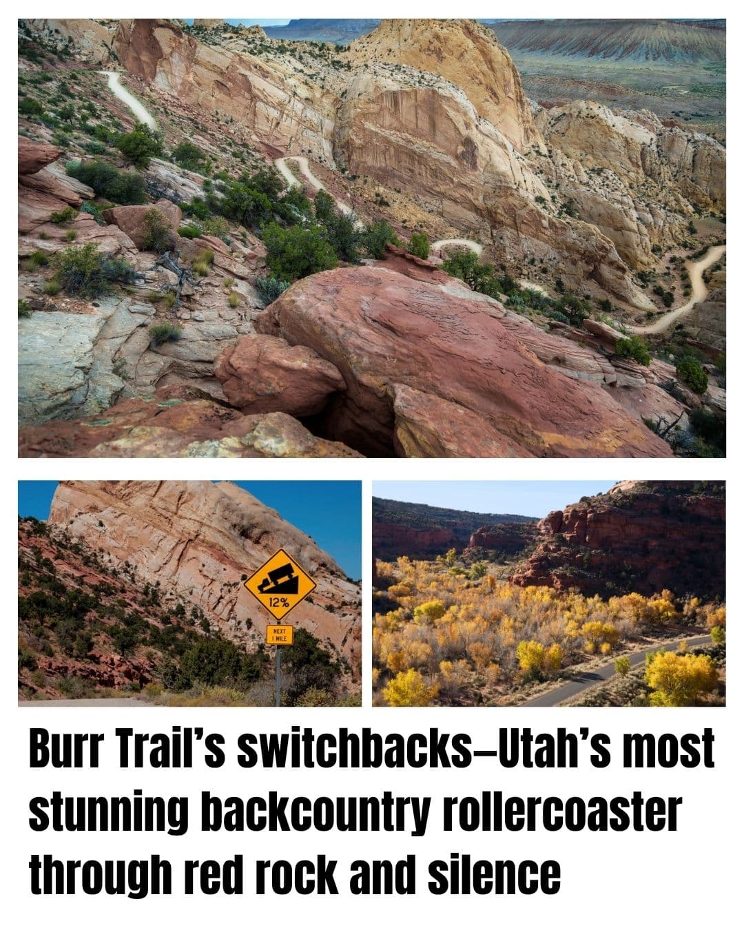
Burr Trail Scenic Backway: Utah
- Remote, red rock wonderland hidden from the crowds
- Features famous slickrock, towering slot canyons, and otherworldly vistas
- 66 miles, with over half unpaved, for a true backcountry feel
There’s “off the beaten path,” and then there’s the Burr Trail Scenic Backway.
While most stick to Highway 12, the Burr Trail dives deep into Grand Staircase-Escalante’s maze of canyons and hoodoos; wild, lonely, and perfect for red rock adventure.
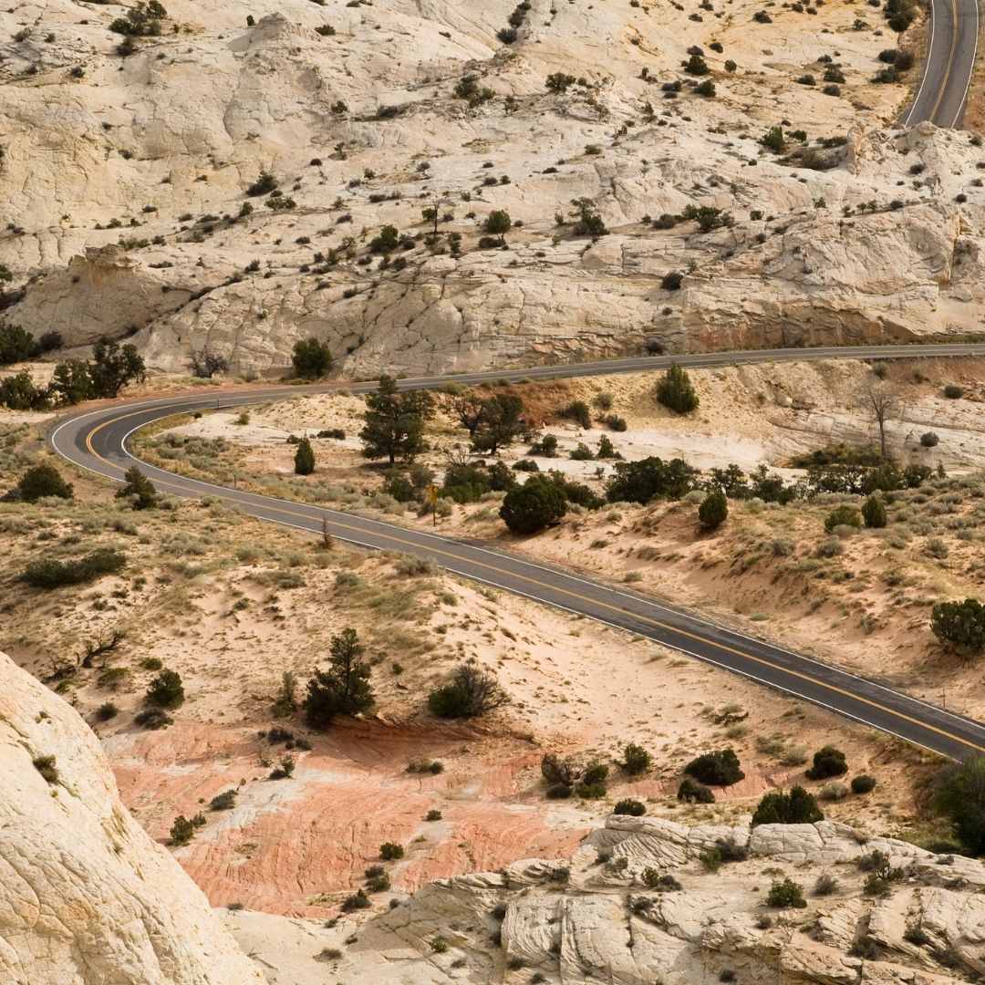
Starting in Boulder, Utah, it winds through cottonwood-lined washes, petrified dunes, and under sandstone cliffs that glow orange in the evening sun.
You’ll pass quiet trailheads, hear your own tires crunching gravel, and discover real silence. Bring a full tank and extra water, there’s no gas, no cell service, and the only traffic might be a lizard on the road.
Best Stretch ⬇️
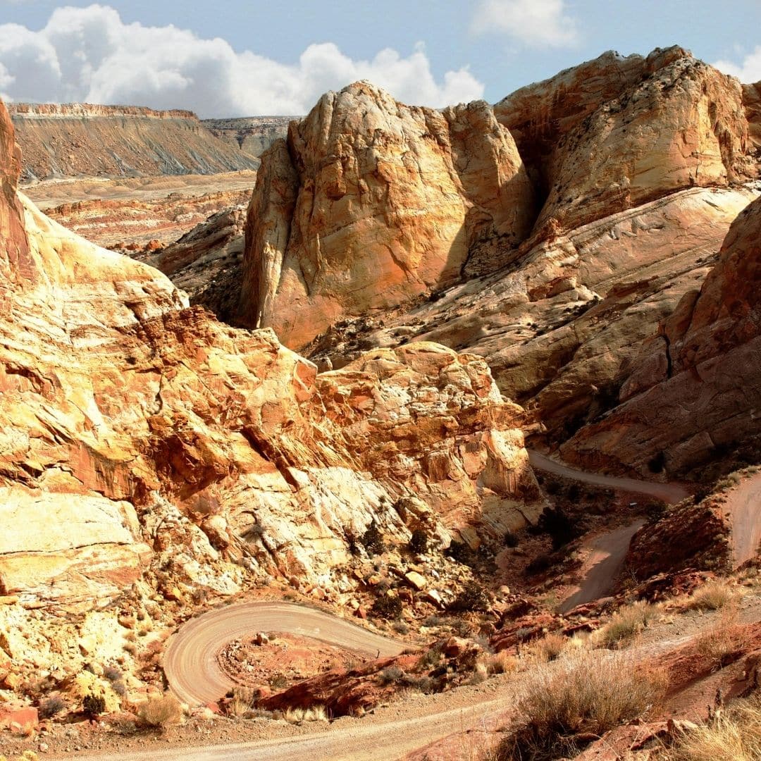
The real showstopper comes at the Burr Trail Switchbacks in Capitol Reef National Park.
Suddenly, the route drops down a series of impossibly tight, gravity-defying hairpins carved into the cliffside, your view explodes into a sweep of rainbow-striped badlands, with the Henry Mountains as a distant backdrop.
It’s a moment that makes even seasoned road trippers catch their breath, and you’ll want to pull over for photos (or just to let your pulse slow back down).
Beyond the switchbacks, the road becomes even quieter, eventually connecting to Notom-Bullfrog Road and, for the truly intrepid, to remote Lake Powell.
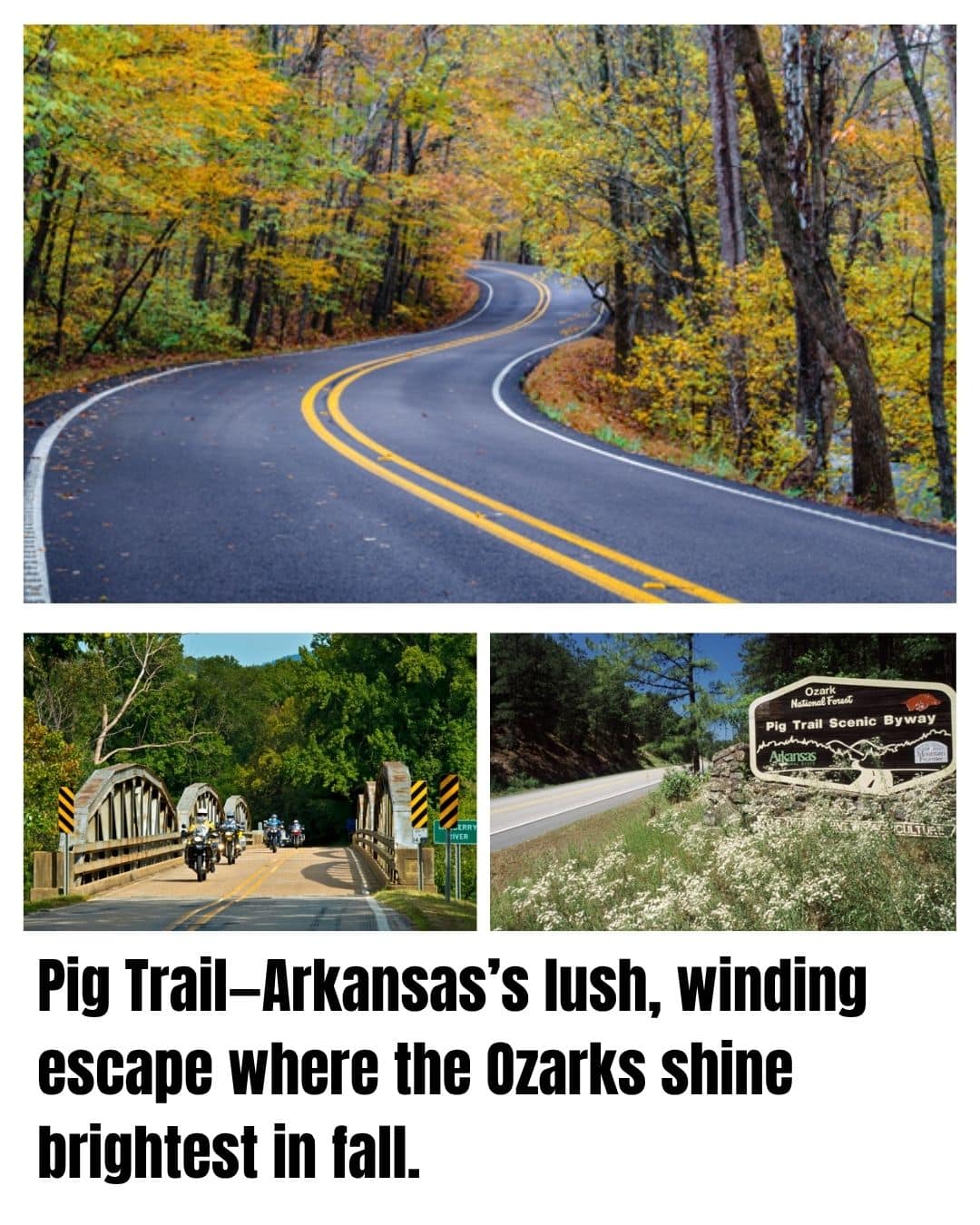
Pig Trail Scenic Byway: Arkansas
- 19 miles of winding mountain road through the heart of the Ozarks
- World-class fall foliage and spring wildflower displays
- A biker’s favorite and a secret local escape
The Pig Trail Scenic Byway is Arkansas at its best, a winding, tree-lined road deep in the Boston Mountains.
Dense forests turn bright green in summer and explode with color each fall. While most people stick to the interstate, locals and motorcyclists love the Pig Trail’s tight curves and peaceful hills.

Drive through shady tunnels, past grazing deer, and alongside the Mulberry River.
Named for old pig drives and now a Razorbacks fan favorite, this byway delivers a classic, laid-back Southern drive that feels untouched by time.
Best Stretch ⬇️
The stretch between Brashears and Turner Bend is the most magical. Here, the road tracks alongside the Mulberry River, with occasional gravel pull-offs for fishing, picnicking, or just dipping your toes in the cool, clear water.
In spring, wildflowers dot the roadside, and in autumn, you’ll find yourself surrounded by a canopy of red and gold. Watch for wild turkeys and hawks soaring overhead.
Highland Scenic Highway: West Virginia
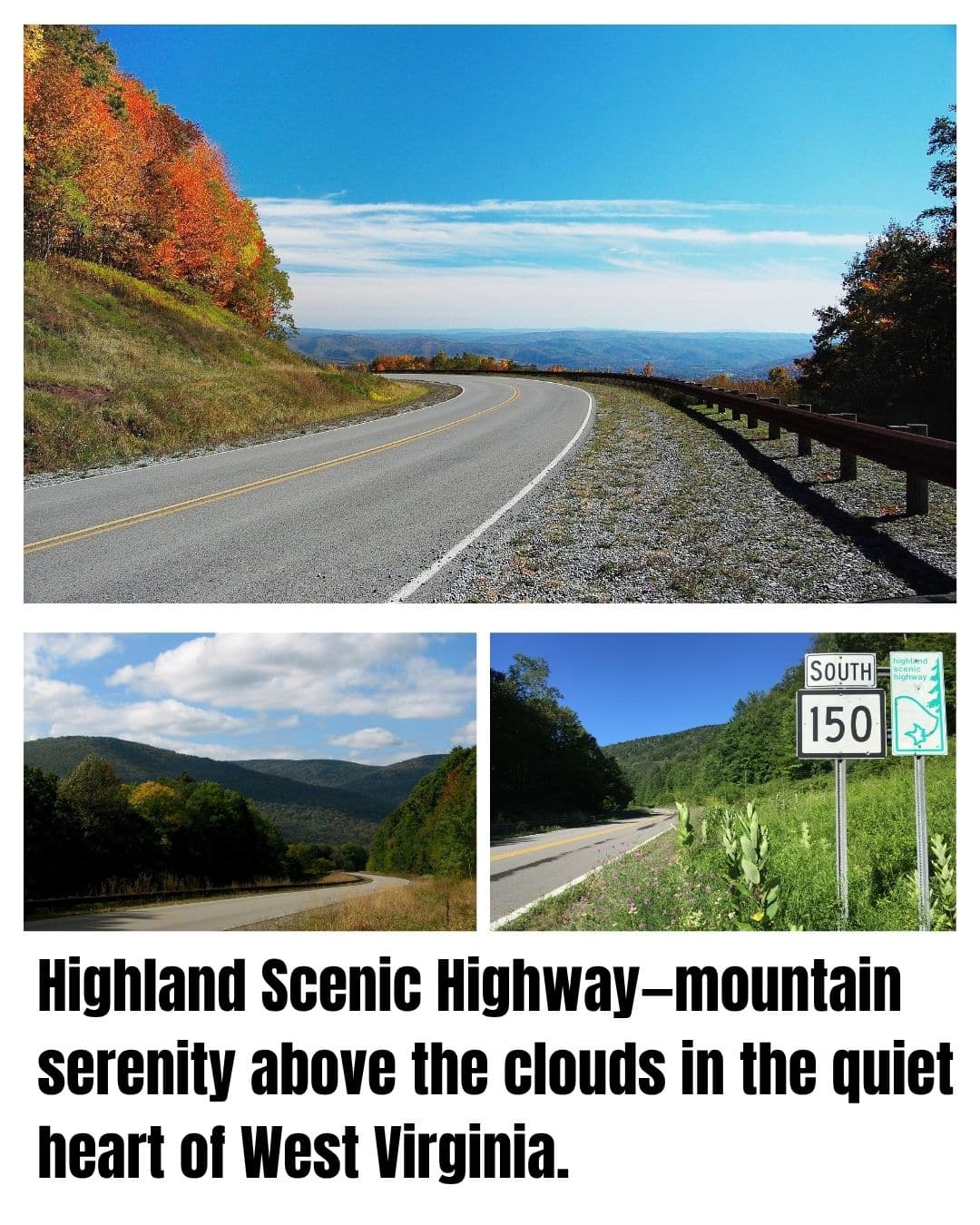
If you think the only great mountain drives are out west, you haven’t tried West Virginia’s Highland Scenic Highway.
This hidden jewel winds through the remote highlands of the Monongahela National Forest, following ridgelines that seem to roll forever.

It’s the kind of road where you might not see another car for miles. Just you, endless green mountains, and the wind in the trees.
The byway passes through spruce and hardwood forest, with wide-open vistas and brilliant fall color. Williams River, Big Spruce, Little Laurel, and Red Lick overlooks offer both scenery and a glimpse into the area’s history.
On foggy mornings, clouds slip through the ridges and the air is thick with the scent of moss and pine.
Best Stretch ⬇️
The highest portion, along WV-150 near Little Laurel Overlook, is the heart of the drive.
Park at the overlook, step out, and take in endless waves of forested ridges rolling into the blue distance—wild, quiet, and unspoiled.
Lamoille Canyon Scenic Byway: Nevada
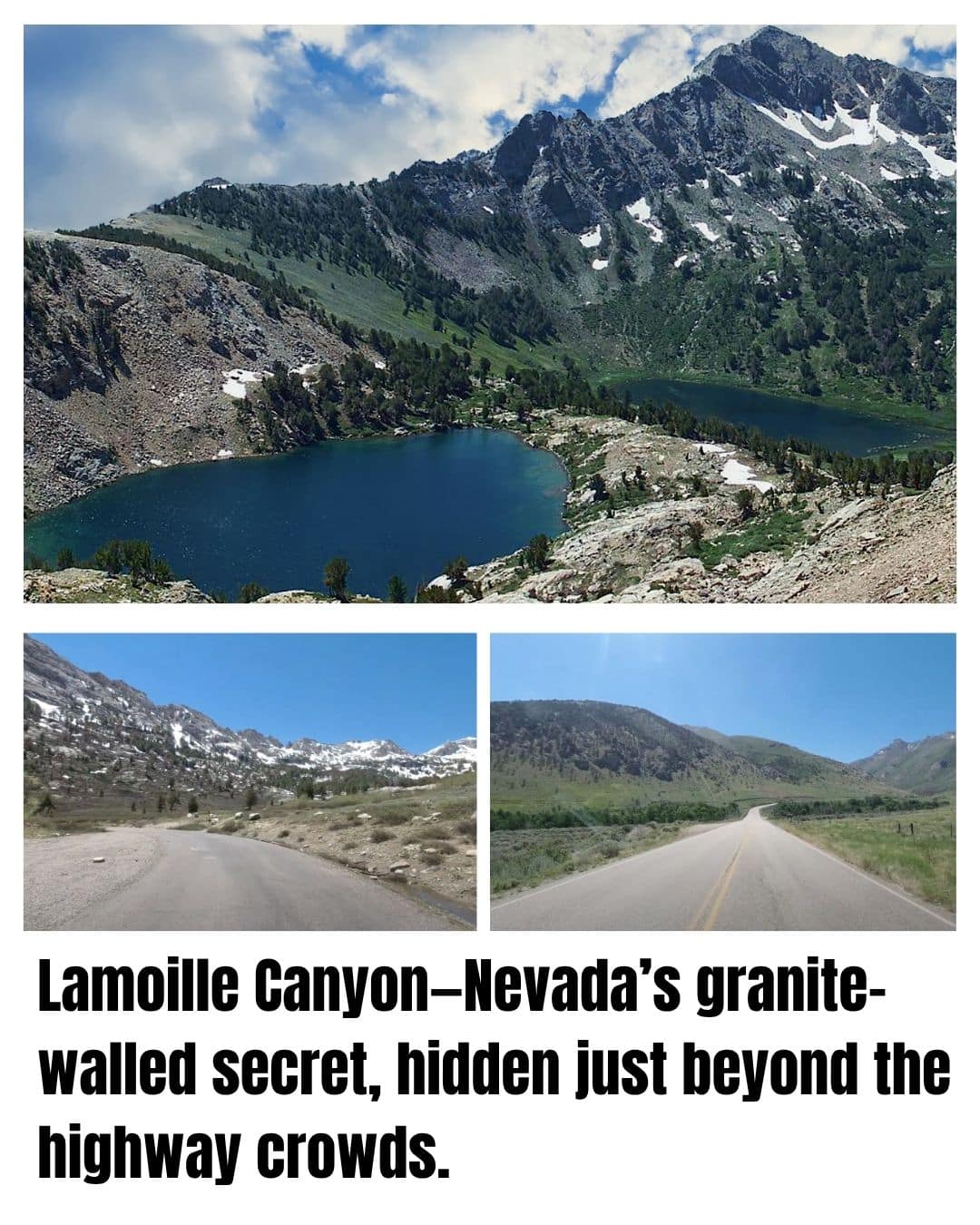
- “Yosemite of Nevada” with sheer granite walls and wildflower meadows
- Only 12 miles long, but packed with year-round waterfalls and alpine views
- Completely overlooked by most travelers on I-80
Forget the casino lights, Lamoille Canyon Scenic Byway shows off Nevada’s wild mountain side. This short, stunning road cuts deep into the Ruby Mountains, often called “Nevada’s Alps.”

Granite cliffs rise above green valleys and summer snowfields, while aspen groves and wildflowers brighten the meadows. The air is crisp, and you might spot mule deer, mountain goats, or an eagle soaring overhead.
You’ll find interpretive signs, picnic spots, and trailheads all along the route, making it a perfect escape from Elko into Nevada’s alpine beauty.
Best Stretch ⬇️
The last few miles near Road’s End are the highlight. Here, canyon walls close in, waterfalls tumble from hanging valleys, and you can picnic beside crystal-clear Dollar Lake.
If you want to stretch your legs, take the short hike to Island Lake or simply enjoy the spectacular vista from the parking area.
Coronado Trail: Arizona
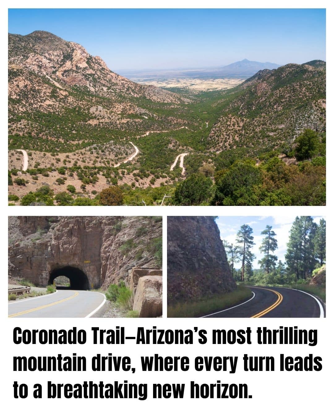
- 120 miles of wild, twisting mountain road with over 400 switchbacks
- Climbs from desert floor to cool, forested heights at 9,000 feet
- Historic “Devil’s Highway” (US-191), barely changed in a century
If you crave hairpins and jaw-dropping views, Arizona’s Coronado Trail is pure driving adventure.
Once called US-666 (“the Devil’s Highway”), it’s a road with endless turns, no billboards, and almost no guardrails.

You’ll climb quickly from desert lowlands into thick forests of ponderosa pine and Douglas fir, often spotting elk or wild turkeys along the way.
The route is truly remote—just old mining camps and tiny settlements dot the path. In autumn, the mountains glow with yellow aspens; in summer, the air is cool and crisp. If you’re lucky, you’ll watch a thunderstorm roll in and fill the canyons with drama.
Best Stretch ⬇️
Near the Blue Vista Overlook, you’ll reach the high point at nearly 9,000 feet, with sweeping views across the Blue Range and all the way to New Mexico on a clear day.
Pull off, breathe deep, and enjoy the feeling of being on top of the world.
Cherohala Skyway: Tennessee & North Carolina
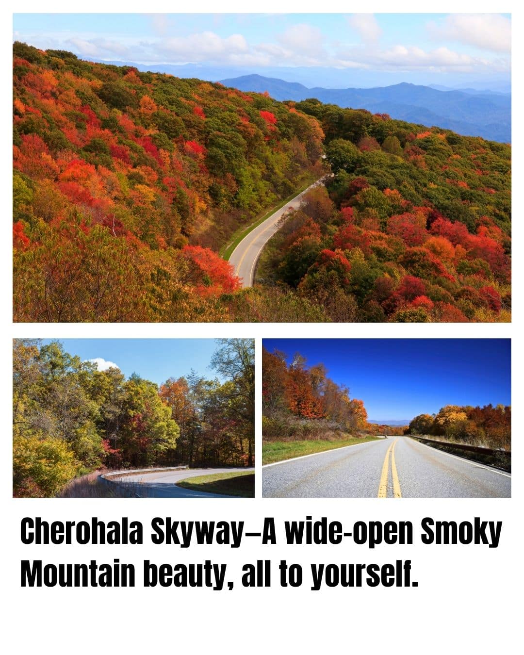
- 43 miles of wide, winding pavement over 5,400-foot peaks
- Epic Smoky Mountain views, zero tourist crowds
- Named for the Cherokee and Nantahala National Forests it links
The Cherohala Skyway is the Smokies’ best-kept secret, a smooth, modern byway with epic views, wildflowers, and almost no traffic.

Built for scenery, it climbs from Tellico Plains, Tennessee to the state line, then drops into the Nantahala National Forest.
You’ll crest ridge after ridge, with every pull-off revealing layers of blue mountains.
Unlike the busy Blue Ridge Parkway, this skyway stays serene, just wind in the trees and maybe a hawk overhead.
Best Stretch ⬇️
The top stretch, from the state line to Santeetlah Overlook, delivers the biggest open panoramas, with the mountains of both states falling away in every direction.
The overlook is the perfect spot for sunrise or sunset, with colors shifting over the rolling landscape.
Big Bend Scenic Byway: Florida
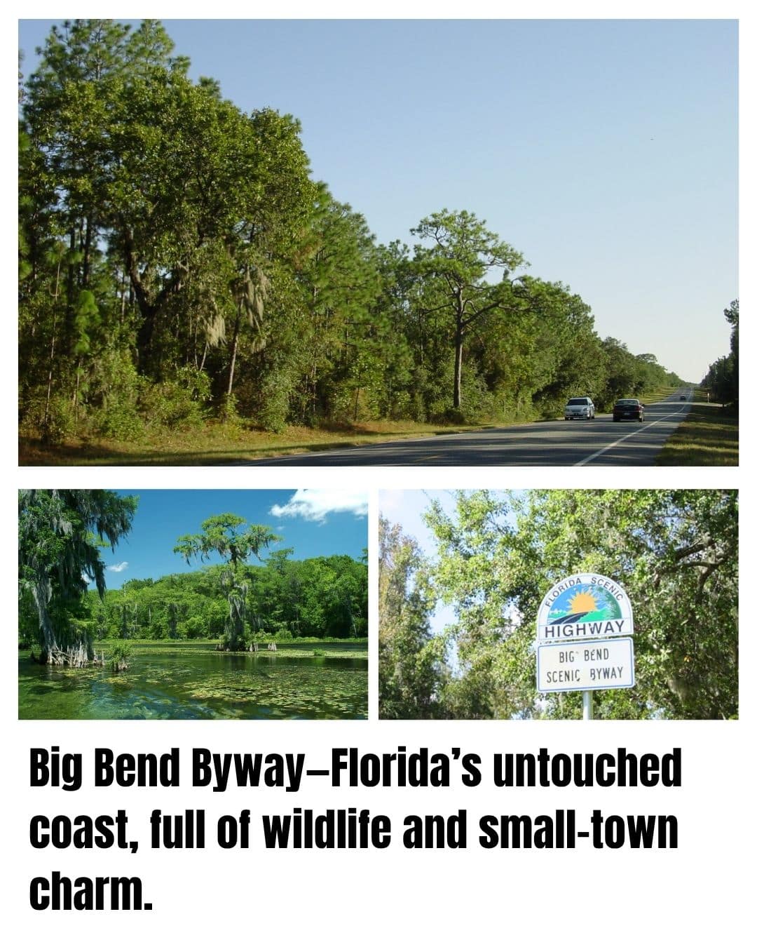
- 220-mile loop through the Forgotten Coast’s wild beaches and pine forests
- Marshes, sleepy fishing towns, and rare wildlife along the Gulf
- Feels untouched- just small towns, old oaks, and salty air
Most folks picture theme parks or crowded beaches, but the Big Bend Scenic Byway reveals Florida’s hidden side.

This is Old Florida: palmetto scrub, salt marshes, and quiet fishing towns where time stands still.
Cruise along two-lane roads past shrimp boats, seafood shacks, and white herons in the shallows.
The air is scented with pine and salt. In spring, wildflowers bloom roadside. Watch for dolphins offshore or an alligator sunning by the ditch.
Take your time, there are plenty of pull-offs for fresh oysters or a walk on an empty beach.
Best Stretch:
The 40-mile ribbon of US-98 between Panacea and Apalachicola is pure coastal beauty.
The road hugs the Gulf, curving past white sand, quiet bays, and classic small-town storefronts. Apalachicola itself is a gem—famous for oysters, Victorian architecture, and riverfront views.
Sandhills Journey Byway – Nebraska
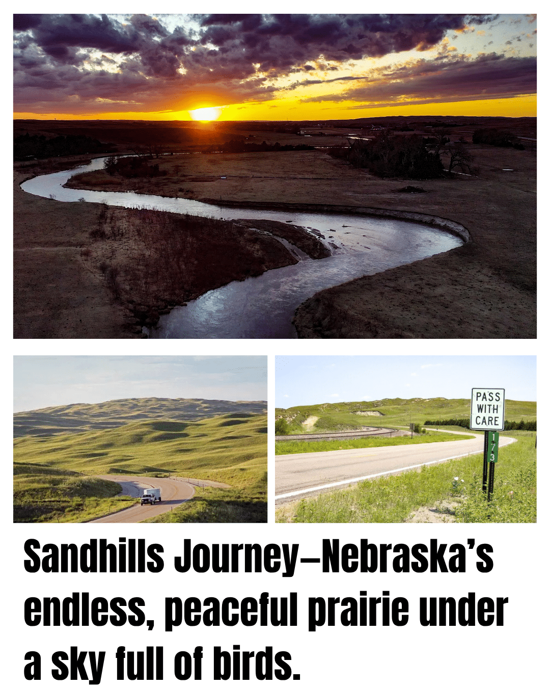
- 272 miles of rolling prairie, wild dunes, and endless sky
- Home to the legendary sandhill crane migration
- Old ranches, little towns, and the heart of the Great Plains
The Sandhills Journey Byway isn’t about high drama—it’s about the vastness and peace of real America.
This road cuts through one of the world’s largest grass-stabilized dune fields, with native prairie stretching to every horizon.
You’ll drive past old windmills, tiny towns, and cattle ranches where nothing’s changed in generations.
In spring, the skies fill with hundreds of thousands of sandhill cranes—one of the world’s great wildlife spectacles.
Birders and nature lovers flock here to see the sunrise flocks, but most of the year, it’s just you and the open road. The land is alive with meadowlarks, hawks, and the sound of wind.
Best Stretch ⬇️
Between Thedford and Halsey, the heart of the Sandhills, you’ll find gentle rolling dunes, wide rivers, and a sky that seems bigger than anywhere else. Stop at a prairie overlook, watch for grazing deer or a hawk riding the thermals, and enjoy a landscape that feels both ancient and alive.
Cascade Lakes Scenic Byway – Oregon
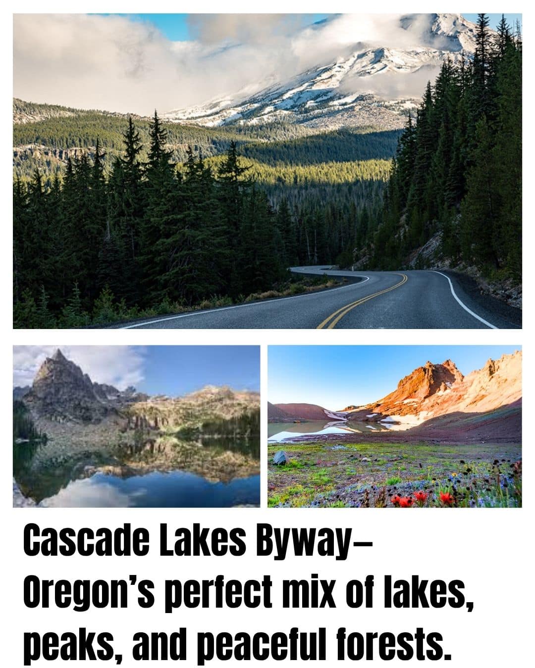
- 66 miles from Bend through the heart of volcano country
- Dozens of lakes, lava flows, and the mighty Three Sisters
- -deal for summer camping, paddling, and scenic pull-offs
Start in Bend and the world changes quickly. The Cascade Lakes Scenic Byway climbs through ponderosa pine forests, passes volcanic peaks, and opens up to lakes so blue you’ll swear they’ve been retouched.
The drive is peppered with roadside lakes—some small and mirror-still, others big and breezy, perfect for canoeing or a picnic.
In summer, wildflowers bloom beside the road, and every stop offers a new view of snow-capped volcanoes reflected in glassy water.
At sunrise, the mountains glow pink and gold. In autumn, larches add pops of yellow among the evergreens. The air is crisp and clear, and traffic is usually light except on holiday weekends.
Best Stretch ⬇️
From Sparks Lake to Elk Lake, you’re flanked by shimmering water and towering peaks—the Three Sisters, Broken Top, and Mt. Bachelor all loom above.
Each lake has its own character, from family-friendly beaches to wild backcountry camps.
Copper Country Trail – Michigan
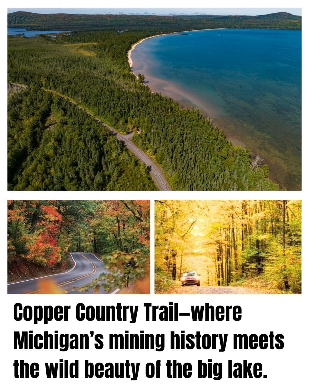
- 47 miles along US-41 through the Keweenaw Peninsula
- Lake Superior shorelines, copper mining history, and forests ablaze in fall
- Classic Upper Midwest adventure—cool breezes, big water, wild woods
Michigan’s Copper Country Trail is pure Northwoods magic. Up on the Keweenaw Peninsula, this route hugs the Lake Superior shoreline, twisting through dense forests and passing through old mining towns that hint at the region’s boom years.
In autumn, the trees explode with color; in summer, the lake breeze smells fresh and piney.
You’ll see mining ruins, tiny roadside museums, and plenty of hidden beaches where you can hunt for agates or dip your toes in the (bracingly cold) water.
Keep your camera ready for classic lighthouses, cliffside lookouts, and occasional sightings of moose or eagles.
Best Stretch:
The final approach to Copper Harbor is unforgettable—especially if you take a side trip up Brockway Mountain Drive.
The road climbs high above the forest, offering panoramic views across endless woods and the endless blue of Lake Superior
Silver Thread Byway – Colorado
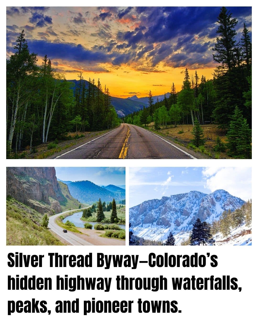
- 117 miles of old mining country, waterfalls, and alpine vistas
- Connects three classic mountain towns: South Fork, Creede, and Lake City
- Light traffic, wild scenery, and a real taste of Colorado’s frontier past
The Silver Thread Byway is where you go to find the real Colorado, far from the crowds. It winds through canyons and meadows, over high passes, and past ghost towns that tell the story of the state’s mining boom.
Waterfalls spill from the cliffs; deer and elk are a common sight along the roadside.
You’ll feel the elevation change as you cross Spring Creek Pass (over 10,800 feet!), and every descent brings you into a new valley full of wildflowers and old wooden cabins.
The route is open year-round, though snow makes it a very different adventure in winter.
Best Stretch ⬇️
From Spring Creek Pass down to Lake City, the road swoops past the thundering North Clear Creek Falls, skirts the rugged profile of Uncompahgre Peak, and glides beside the brilliant blue waters of Lake San Cristobal—all with hardly another car in sight.
Denali Highway – Alaska (Unpaved)
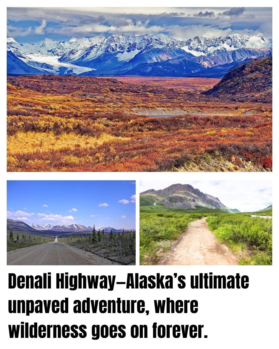
- 135 miles of gravel across open tundra and glacial valleys
- Jaw-dropping views of the Alaska Range and Denali itself (on clear days)
- No crowds, few services—just wild beauty and true adventure
One of America’s last true wild roads, the Denali Highway is more an expedition than a drive.
For much of its length, you’ll see no sign of human development, just rolling tundra, sparkling rivers, and the snowy bulk of Denali dominating the northern horizon.
You’ll likely spot caribou, moose, and maybe a grizzly, and the silence is so deep you’ll forget the rest of the world exists.
The road is gravel, sometimes rough, and you need to be self-sufficient—bring extra fuel, food, and a spare tire.
It’s open only from mid-May to mid-October, but for those who make the trek, it’s an unforgettable journey through one of Earth’s last, best wild places.
Best Stretch ⬇️
The area around Maclaren Summit offers endless views of the Alaska Range, with rolling tundra at your feet and huge, snowy mountains on the horizon. In late June and July, wildflowers turn the landscape pink and purple, and the sun barely sets.
Schoodic National Scenic Byway – Maine
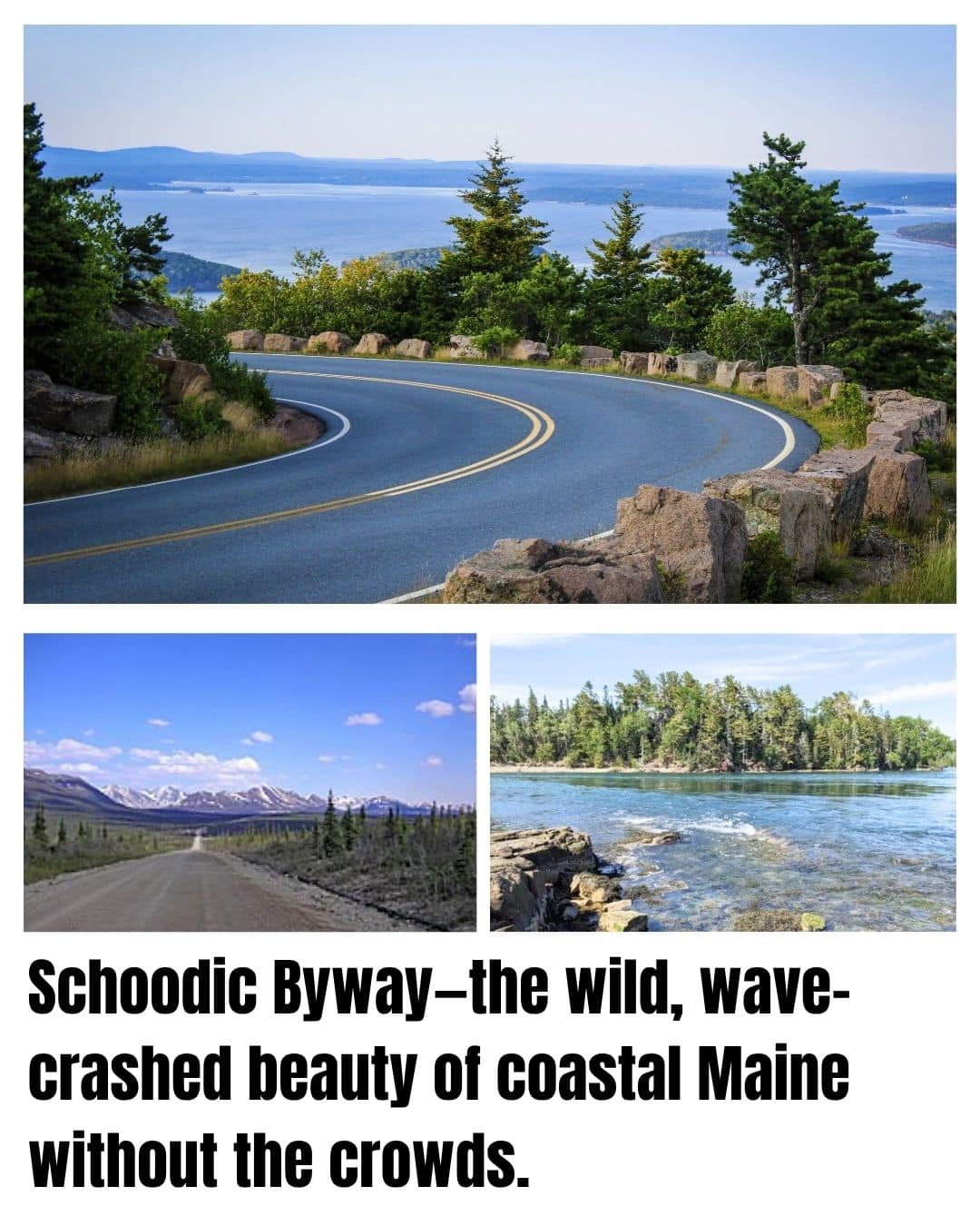
- Acadia’s wild, uncrowded peninsula with bold granite coast
- Classic New England fishing villages, lobster boats, and spruce woods
- More surf and seabirds than selfie sticks
While most visitors crowd into Acadia’s main park loop, the Schoodic National Scenic Byway offers the Maine coast as it once was: rugged, peaceful, and full of the sounds of crashing waves and calling gulls.
The route curls around the Schoodic Peninsula, through small towns like Winter Harbor and Birch Harbor, with glimpses of working harbors and old lighthouses.
Here, the Atlantic puts on a show—huge surf pounds the pink granite, sea spray fills the air, and tidepools teem with life. The forests are cool and mossy, and you can smell balsam and salt in the wind. This is classic Down East Maine, away from the tour buses.
Best Stretch:
The Schoodic Loop Road, especially around Schoodic Point, offers quiet pull-offs for watching the waves thunder against the rocks, with seabirds swirling and lobster boats heading out at dawn.
There you go—thirteen incredible byways, twice as detailed, twice as evocative, and every bit as ready for your next adventure! Thanks for reading!